- Home
- Product
- STUDIO
STUDIO
An intuitive editor that converts images into digital spatial information.
Build and manage digital spatial MAPS
with STUDIO using AI technology.
STUDIO is a cloud-based service that allows you to create/modify/manage MAPS data quickly and easily. Manage spatial information efficiently and maintain the latest data with various features of STUDIO.
Features
modification of MAPS
-
 Vector editing
 -
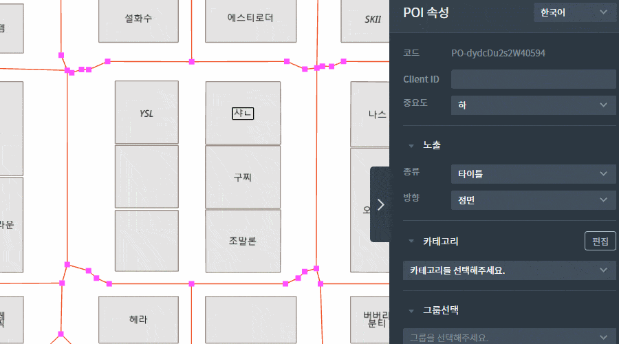
 POI registration
 -
 Numerous themes
for MAPS -
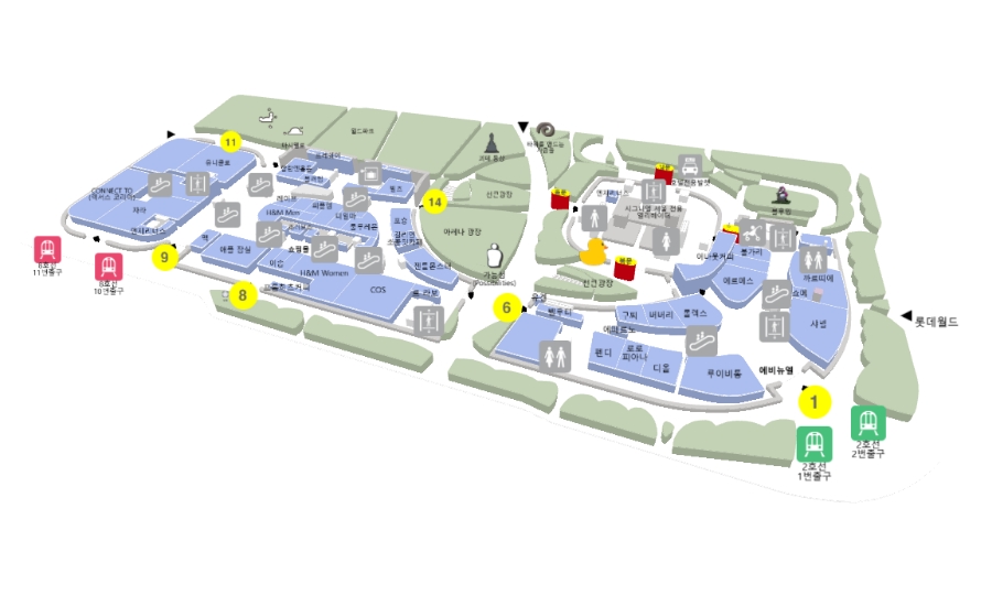
 Indoor wayfinding
-
 Real time update
 -
 User management
 -
 POI management
 -
 Analytics
Core Technology
The Key features of STUDIO.
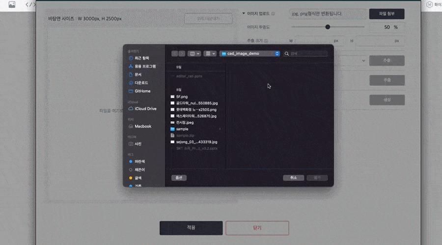
Using our AI technology, you can edit existing map formats such as CAD/png/jpg by converting them into geospatial MAPS. In addition, MAPS is provided in multiple formats so it can be easily applied to other platforms.
-
Image to data
Read Raster formatted images through AI and convert them into geospatial information in Vector form.
-
Supporting various formats (input)
Various data types such as shp, geojson, and svg can be imported and converted into spatial data.
-
Supporting various formats (output)
Spatial data can be exported into standard format data such as geojson and svg.
Provides various features to create desired spatial information. You can create indoor and outdoor maps quickly and easily with user-friendly editing features.
*POI: abbreviation for Point Of Interest, facilities marked on the map.
-
Information Creation and Editing
Create and edit geometric shapes such as points, lines, and surfaces in vector form, and create and edit nodes/links information for wayfinding
-
Edit POI’s property
Attribute assignment and modification, creation and editing of POI attributes of spatial information
-
Edit style
Edit color, transparency, etc.
-
Management of a large number of POIs and APIs
Ability to import/export a large number of POIs in Excel format, modify/delete POIs in other external places through API
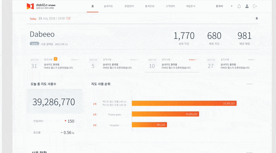
Manage a large number of spatial information more effectively.
Multiple users can access and manage it in real time and use analytics to measure usage.
-
Management
Save, search, copy, share, and manage access rights.
-
Distribution
Ability to distribute through apps, web, etc.
-
Analytics
Aggregate and visualize the use of spatial information

Provides an interface that can use the spatial information of Dabeeo MAPS on the website and mobile app.
It can be implemented into various location-based services with technical documentation and examples.
-
Provides the correct format of maps for your needs
Provides 2D and 2.5D maps: flat or realistic shapes.
-
Display control
Intuitive touch or mouse control
-
Recommends the shortest path
Ability to identify the shortest pathway between two points.
-
Indoor/Outdoor location tracking
Shows the location using GPS, marker, and Web-XR
Use Case
Use cases of the STUDIO


Use the data of MAPS more effectively.