- Home
- Product
- MAPS
MAPS
Customized digital maps are for all the spaces around us and for virtual spaces.
Always offer up-to-date, accurate
indoor and outdoor digital maps.
Using Dabeeo’s digital map can express all the spaces around us. Achieve optimal location-based services with customized digital maps that can be applied indoors and outdoors.
Why
Dabeeo’s MAPS?
- 01High
versatilityapplicable to all areas
indoors and outdoors - 02Effective Information
use with high usage
through APIs - 03Simple
updatereal-time update
by STUDIO - 04Various platforms
Can be shared across various platforms, including mobile, web & Kiosk
- 05Reasonable production cost
Cost-saving solution with reasonable production cost, high usability, and central management
- 06Short production time
Dabeeo's AI technology can convert images to digital data quickly in order to cut down production time
- 07Low-capacity data
Vector-based low-capacity indoor map data
- 08Enhancing the experience
with accurate location information and destination Search
MAPS Product
Check out the features of each MAPS product
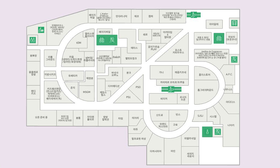
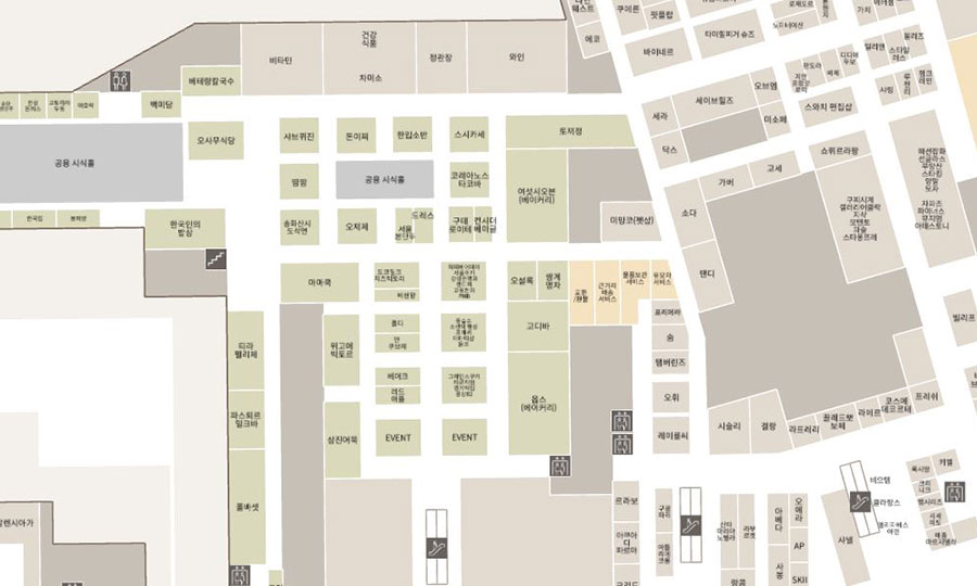
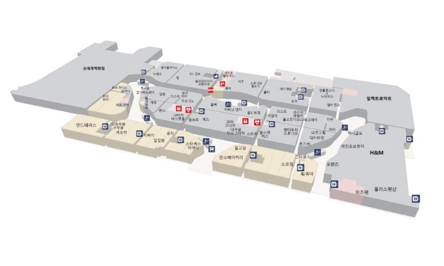
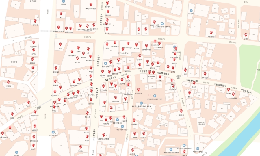
Organizations can manage stores and facilities using STUDIO intuitively and effectively. With destination search and wayfinding, customers can quickly find the information they need.
For complex indoor environments, efficient data handling is essential.
If you want to manage indoor spatial information quickly and provide helpful information to visitors, try Dabeeo MAPS.
- Filed of application
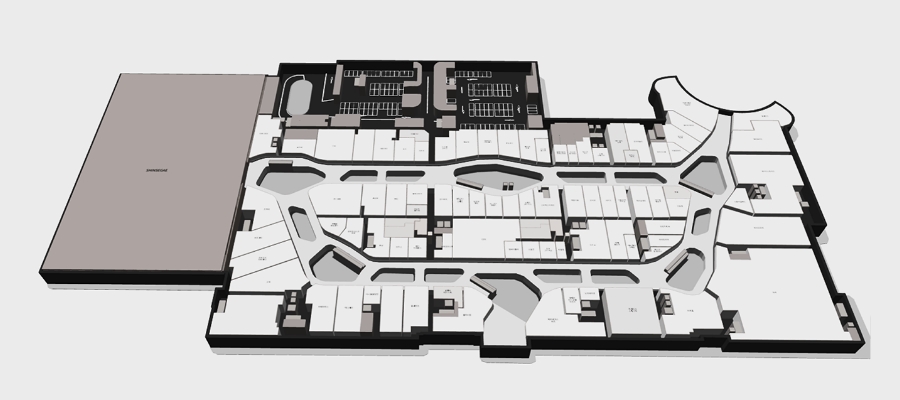
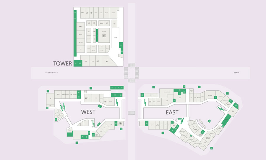
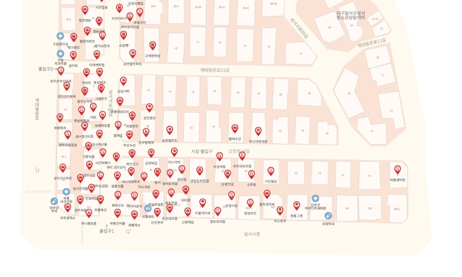
- Indoors include shopping malls, markets, subway stations, manufacturing facilities, warehouses, and enterprise buildings.
- * Maximum available area : ~1,000,000 sqm
- * DATA Format : JSON, GEOJSON, SVG, JPG etc
- * Maximum number of points of interest (POI) : ~1,500 can be set
- * Maximum number of attribute classifications : ~50 can be set
- * DATA customization status: : Possible
Organizations can manage stores and facilities using STUDIO intuitively and effectively. With destination search and wayfinding, customers can quickly find the information they need.
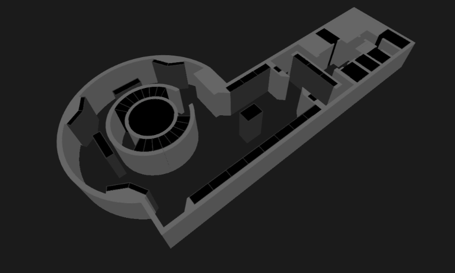
Large indoor and outdoor mixed spatial data can also be created based on the customer’s service needs. We offer seamless environments with various space experiences.
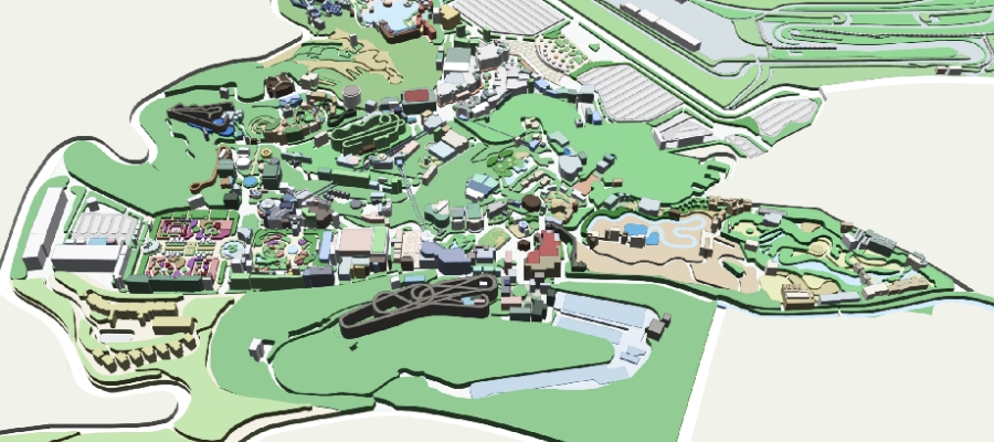
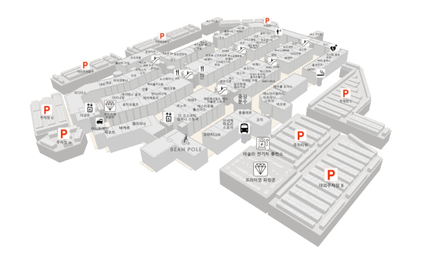
- Field of application
- Amusement parks, concert halls, premium outlets, tourist attractions, universities, etc
- * Maximum available area : ~2,000,000 sqm
- * DATA Format : JSON, GEOJSON, SVG, JPG 등
- * Maximum number of points of interest (POI) : ~3,000 can be set
- * Maximum number of attribute classifications : ~100 can be set
- * DATA customization status: : Possible
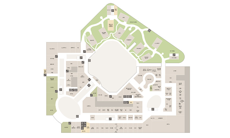
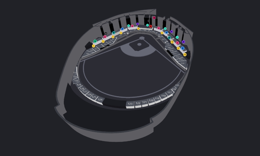
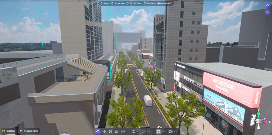
Technology for large-scale monitoring and location 3D data conversion can be used in digital map building and the environmental monitoring metaverse.

Outdoor spatial information can be digitized and provided as various services. Map services in daily life can be updated using the extracted data from the changes in spatial information. Satellite and aerial images can also be used to create digital twin and metaverse worlds.
- Field of application
- MAPS, Navigation, Digital Twin, Metaverse
- * Maximum available area : 2,000,000 sqm~
- * DATA Format : GEOJSON, FBX
Use Case
Check out many customers
use cases with MAPS
Process
In-depth communications with the users and the administrators are required to create the right MAPS for their purpose of use and environment.
-
Plan
- Submit Inquiry
- Prepare a contract
- Gather requirements
-
Production
- Design the Map
- Map creation and review
- Correction and improvement
-
Publishing
- Provide the Map through API
- Customer approval
- Publish the Map
-
Operation
- Ongoing map updates and
management with STUDIO
- Ongoing map updates and
Dabeeo’s spatial data is used by various customers.