- Home
- Product
- INTELLIGENCE
INTELLIGENCE
Dabeeo's deep learning AI technology can analyze various spatial data/images.
Explore and digitize the spatial information by Dabeeo's
lNTELLIGENCE in a rapidly changing environment.
Dabeeo’s technology is optimized for the areas that require in-depth spatial analysis and data extraction. With the help of Dabeeo’s AI and image deep learning technologies, gain the business insights you need.
Why
Dabeeo’s INTELLIGENCE?
Analytics based on Dabeeo’s deep learning AI INTELLIGENCE for an extensive range of image data. Achieve accurate, high-quality results with five essential technologies with lower labor costs.
Core Technology
The key features of intelligence technology
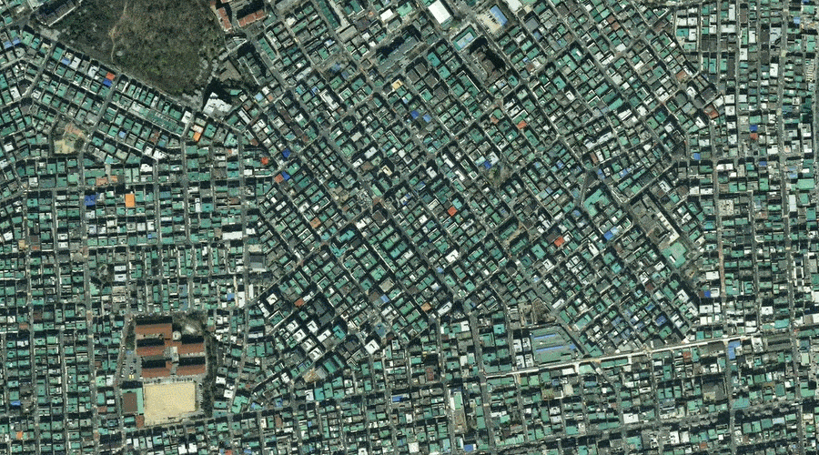
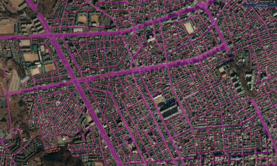
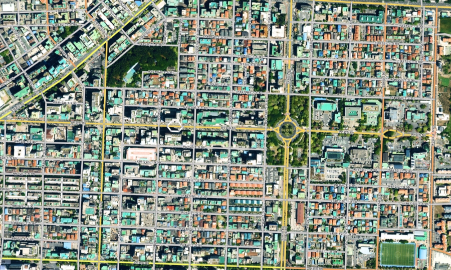
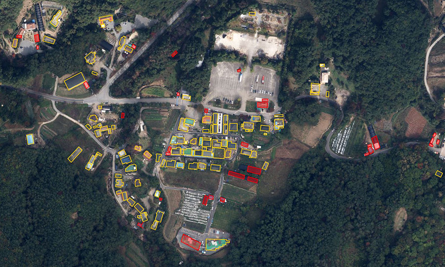
Using a variety of video images, including satellite, aerial, and drone footage Using the Instance Semantic Segmentation algorithm, determine the precise measurements of buildings and roadways.
- Features
- Provide spatial information for a large area more efficiently and precisely.
- Resource
- RGB image data from satellites, airplanes, drones, etc.
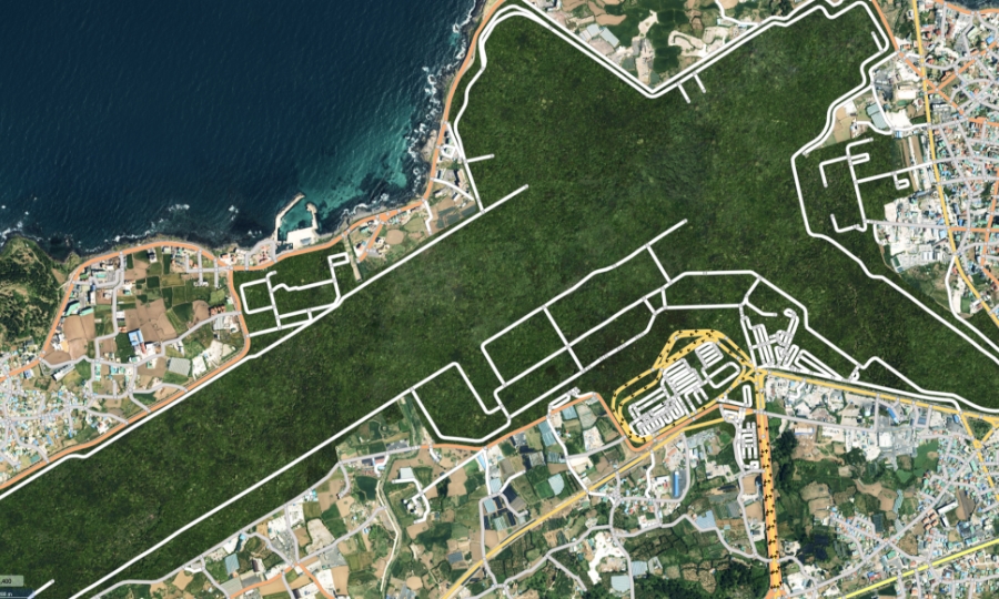
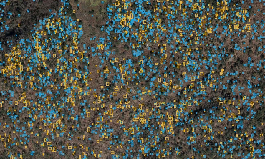
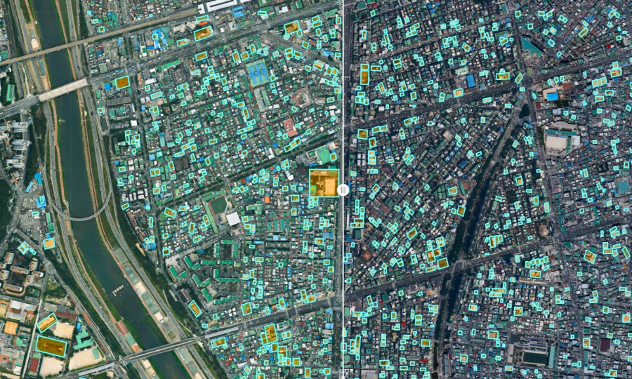
Debeeo's INTELLIGENCE deep learning technology detects specific objects and counts in a wide range with high accuracy.
- Features
- 10 cm/pixel~50 cm/pixel can be used according to their image resolutions.
Invisible and/or vast numbers of objects can also be found easily.
- Resource
- Satellite, Aircraft, Drone, CCTV, Mobile Camera, etc., and RGB video data.
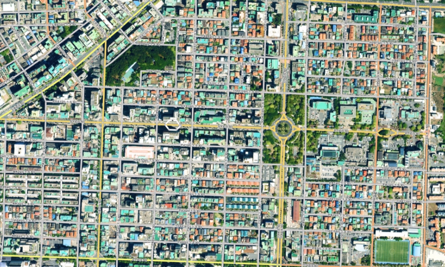
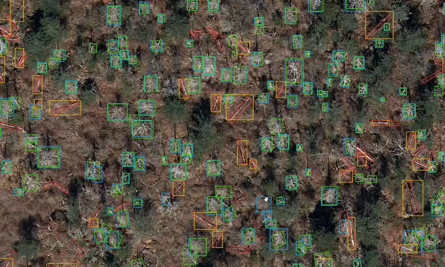
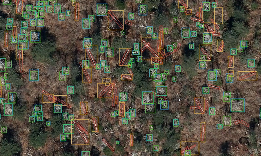
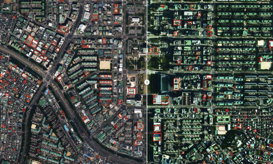
Detect changes in time laps and distinguish new object creation or damage to the landscape.
- Features
- DATA determination manually by humans can be obtained easily through INTELLIGENCE.
- Resource
- Satellite, Aircraft, UAV Drones etc., RGB video data.
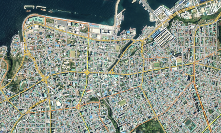
The more high-quality image used in INTELLIGENCE, the more accurate boundaries of objects are clarified, allowing object detection and area division with increased accuracy to get more information.
- Features
- Dabeeo’s latest AI technology converts low-resolution images to high-resolution and enhances the accuracy of deep learning data.
- Resource
- Satellite, Aircraft etc., RGB video data
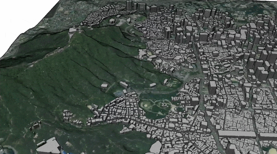
Technology to create a video of landscapes using Satellite/Aircraft/Drone technology to build 2.5D modeling of individual objects and high precision of 3D interspace information.
- Features
- Indoor and outdoor 2.5D building models or high-precision 3D models can be created using 2D video.
- Resource
- Aircraft, Drone capture, Satellite video or RGB-D image or Depth video.
Use Case
Efficiently improve the work process
with Dabeeo’s INTELLIGENCE technology.
Both domestic and international customers have
recognized Dabeeo’s Geoint. INTELLIGENCE technology.
Open 24/7 for inquiries. Contact us.